Skip to content

A constantly changing landscape

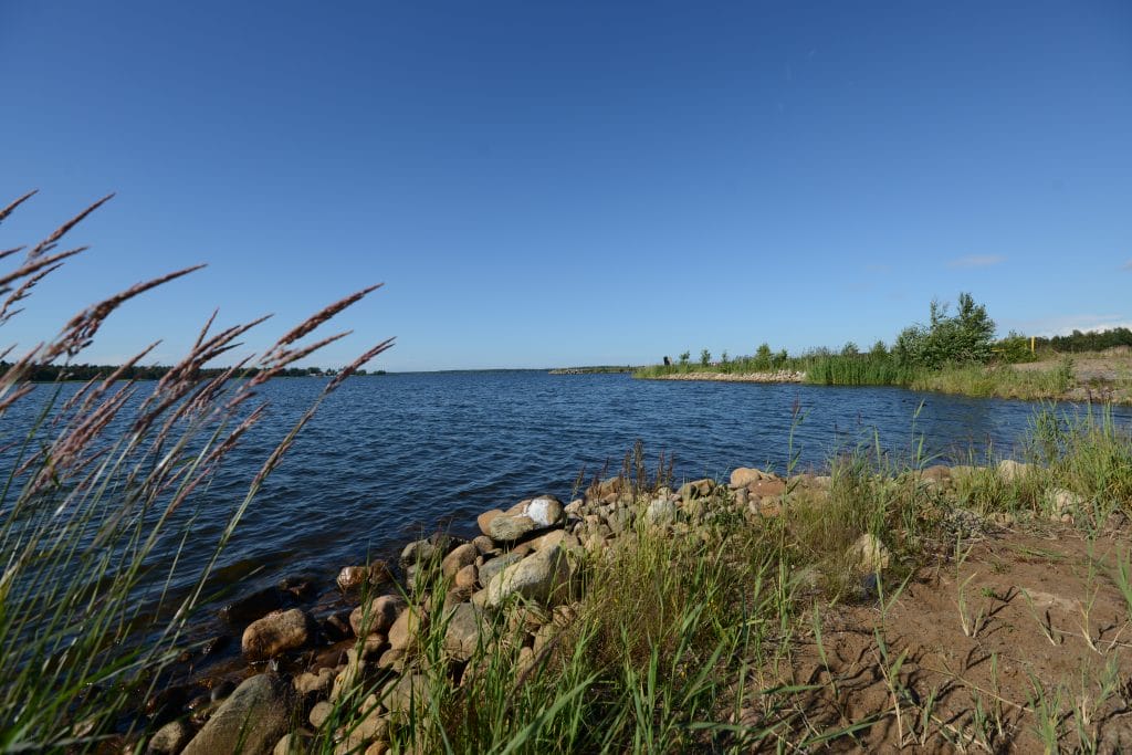
The phenomenon of land uplift has always had significant influence on the interaction between the sea and the land in Kokkola. Its effects can be seen at the park’s nature sites in many ways. The flads and gloes, ancient cobble fields, woodlands and shorelines of the high coast show signs of a constant state of flux. The receding sea exposes new land that has not been dry since the last ice age. New islands, shallows and rocky reefs are constantly emerging. Islands become capes, and boat routes become too shallow to navigate. Land uplift continues to be rapid enough for landscape changes to be detectable in the space of one human life.

Some of the sea and shore areas of the park are Natura 2000 sites. Land uplift creates diverse habitats in the coastal area, including valuable bird sites on the islands of the outer archipelago. The rocky coast with its dense island network creates a unique submerged habitat for aquatic life. Kokkola’s coastal area provides nesting sites for various seabird species, and it is one of the most important nesting sites of the Caspian tern in Finland.

  •  

    Diverse and expansive nature areas and the visible signs of land uplift are key features of Kokkola National Urban Park. Land uplift means that the coastal environment is constantly changing. It enables the spread of various flora and fauna to new areas. The vegetative succession process and the creation of diverse habitats are characteristic of the high coast.

    Trullevi is a narrow cape, approximately five kilometres long, that once rose from the sea. In the 18th century it was still an island protecting the Kokkola shipping lane.  Trullevi is home to many animals, including seals, flying squirrels and hedgehogs. There are valuable nature sites in the area, including an ancient shingle beach and coastal meadows and flads created by the rising land. The ancient shingle beach is surrounded by old and diverse coniferous forests, which are formed in the final stage of the succession in land uplift areas. They are rich in decaying wood and polypores found in old-growth forests. Rugged rocks and ribbons of alder woodland along the shore add to the diversity of Trullevi. You can explore the rocks to spot signs of the ice age. Moving glaciers carry boulders that abrade the bedrock, creating what are known as glacial grooves. The glacial grooves reveal the directions of glacier movement during the ice age. Along the shore you can find sea-buckthorn, which is a type species of the high coast and the official plant of Kokkola.

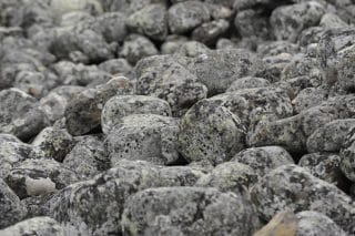
  • Kokkola National Urban Park is home to one of the most spectacular ancient cobble fields of the coastal region. Known as pirunpelto, “devil’s field”, these ancient cobble fields are the result of the accumulation of rock debris dislodged and moved by glaciers. The rocks were pushed onto this site by sea ice and water after the last ice age. As the land rises, waves wash away finer rock debris, and the rocky site has remained completely free of vegetation throughout its one-thousand-year history. As a result of land uplift, the cobble field of Trullevi is now far away from the shore and surrounded by coniferous trees. The Trullevi cobble field was designated as a nature reserve in 2021. The area is 20.4 hectares.

    The cobble field is located 400 metres from the Valkohieta car park along the Trullevi hiking route. It is approximately one kilometre from the fishing harbour at the point of Trullevinniemi.

  • The 12.9 km hiking trail starts from the centre of town and ends at the far point of Trullevi. In winter, the trail is a popular cross-country skiing track. There are two public beaches, Punakallio and Valkohieta, which are popular destinations for families in summer. Punakallio gets its name (“Red Rock”) from the beautiful red-hued rocks which glow in the sun in high summer. Both beaches have toilets and changing rooms. You will find a lean-to shelter at the Valkohieta beach and a campfire site on the Punakallio beach.

    You can join the Trullevinniemi hiking trail from Roskarukka, Kaanaanmaantie, Punakallio and Valkohieta car parks, and the fishing harbour at the tip of Trullevinniemi.

  • The Nisulanpotti nature reserve was established to mark the quatercentenary of Kokkola. The area is approximately 12.5 hectares and part of it is located in Kokkola National Urban Park.

    Nisulanpotti is a former bay which has become isolated from the sea due to land uplift. The flad is approximately 3–4 hectares in size and is connected to the sea by an artificial stream. Sea water continues to reach Nisulanpotti from time to time. A cut-off bay is called a flad when it still has a clear connection to the sea. A flad becomes a gloe when it is connected to the sea only during storms and very high water. When the connection to the sea is lost completely as a result of land uplift, the flad starts to gradually turn into a non-salty gloe lake. Flads, gloes and gloe lakes are unique biotopes that are found only on the Finnish and Swedish high coast.

    The stream connecting the Nisulanpotti flad to the sea has been renovated, as the site is an important fish breeding site. Spring-spawning fish such as perch, Cyprinidae and especially pike rise to spawn in flads and gloes after ice break-up. Water warms up faster in these lush little lagoons than in the sea, which helps young fish develop faster. Locals call them “fish nurseries”.

    Flads also provide sheltered nesting sites and food for various bird species. Nisulanpotti is favoured by many birds; aquatic species such as swans and cranes nest there. The woodland consists of mixed and spruce stands, with rich groundcover and a strong flying squirrel population. The area is further diversified by old meadows and heritage plants.

  • The fishing harbour at the northern tip of Trullevinniemi has a bird tower and an accessible viewing platform, where visitors are treated to stunning views across the vast archipelago and open sea in the heart of the national urban park. The tower offers views towards several beacons, and it is a popular vantage point among storm watchers. It is one of a few places on the mainland shores of Kokkola where you can spot bird species that live in the outer archipelago, including the common eider, razorbill and black guillemot. You can also spot seals frolicking in the sea.

    Binoculars or a telescope is recommended due to the long viewing distances. The fishing harbour has a public toilet (dry toilet), campfire site and boat landing ramp.

  • Bird-rich rising shores

    In Kokkola National Urban Park, the changes caused by land uplift are best seen in the nature conservation area of Rummelö-Harrbådan. Here the landscape has been in a constant state of flux since the last ice age. The succession cycle of vegetation is astonishingly fast on the high coast.
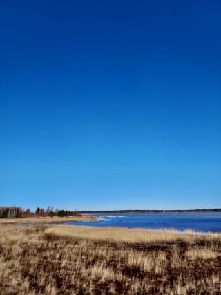
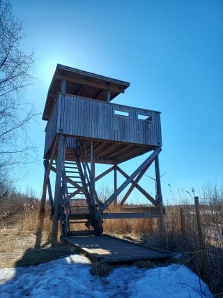
    Harrbådan, or Harrinniemi, is a unique sandy point offering hiking and sightseeing, whether you want to spend a couple of hours or a whole day. The Harrbåda bird tower is located on the western shore of Harrinniemi between the shrub zone and the reeds. The tower is approximately 4 metres tall and can accommodate up to 15 people at a time. The tower is signposted from the parking area next to the Harrinniemi leading light, where you will also find an information board with maps. The bird wetland covers an area of 236 hectares. Rummelö-Harrbådan is one of the most bird-rich sites in Kokkola, and there are often sightings of rare species.
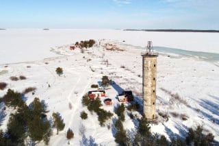
    Leading light of Harrinniemi

    The leading light beacon of Harrinniemi was built on the sandy tip of Harrinniemi in 1953. The leading light is often erroneously referred to as a lighthouse. It was decommissioned in 1979. Since then, the concrete tower has deteriorated severely. At present, the Harrinniemi light is little more than a landmark.
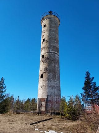
    The run-down light of Harrinniemi has created many ghost stories, the most famous of which is probably the story of the haunting maiden of Harrbåda. According to the story, a family of three was shipwrecked on a stormy night, and the father and son were killed. The young mother was so devastated that she then drowned herself in the sea. The heartbroken maiden still haunts the area and her ghost, wearing a white summer dress, can be seen by those who are soon facing an accident. Anyone with a keen ear can hear the maiden crying desperately near the Harrbåda light.

    A group of small villas, which were built on the shores primarily during the 1920s, are now in amongst the trees far away from the shoreline as a result of land uplift. Isolated from the shore where they once stood, the villas give a tangible view of the impacts of land uplift on human habitation and local villa culture. They are a good demonstration of how fast land rises in Kokkola National Urban Park. The villas also have historical cultural importance, as they reflect the influence of Swedish architecture.